UK Board Class 12 Geography Syllabus in PDF format for free download. Geography syllabus for Class 12 UK Board is now available in the myCBSEguide app. The curriculum for Uttarakhand Board exams is designed by UBSE, Uttarakhand as per NCERT textbooks for the session.
UK Board Class 12 Geography Syllabus Download as PDF
UK Board Syllabus Class 12
- Business Studies Class 12 UK Board Syllabus
- Physics Class 12 UK Board Syllabus
- Chemistry Class 12 UK Board Syllabus
- Mathematics Class 12 UK Board Syllabus
- History Class 12 UK Board Syllabus
- Political Science Class 12 UK Board Syllabus
- Hindi Class 12 UK Board Syllabus
- English Class 12 UK Board Syllabus
- Economics Class 12 UK Board Syllabus
- Sociology Class 12 UK Board Syllabus
- Psychology Class 12 UK Board Syllabus
- Accountancy Class 12 UK Board Syllabus
- Biology Class 12 UK Board Syllabus
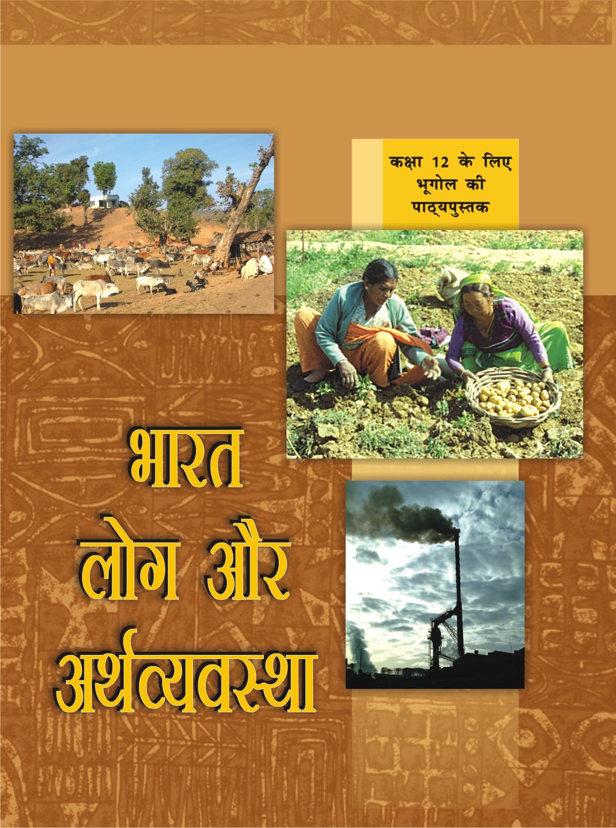
UK Board Class 12 Geography Syllabus
भाग-1
- मानव भूगोल: प्रति एवं विषय क्षेत्र
- विश्व जनसँख्या वितरण घनत्व और वृद्धि
- नसंख्या संघटन
- मानव विकास
- प्राथमिक क्रियाएं
- द्वितीयक क्रियाएं
- तृतीयक और चतुर्थ क्रियाकलाप
- परिवहन और संचार
- अंतर्राष्ट्रीय व्यापार
- मानव बस्तियाँ
भाग-2
- जनसंख्: वितरण, घनत्व, वृद्धि और संघटन
- प्रवास: प्रकार, कारण और परिणाम
- मानव विकास
- मानव बस्तियां
- भू संसाधन तथा कृषि
- जल – संसाधन
- खनिज तथा ऊर्जा संसाधन
- निर्माणउद्योग
- भारत के संदर्भ में नियोजन और सततपोषणीय विकास
- परिवहन और संचार
- अंतर्राष्ट्रीय व्यापार
- भौगोलिक परिप्रेक्षप में चयनित मुद्दे एवं समस्याएं
Uttarakhand Board Class 12 Geography Chapter list in (English)
Geography Book-1
- Human Geography
- The World Population
- Population Composition
- Human Development
- Primary Activities
- Secondary Activities
- Tertiary and Quaternary Activities
- Transport and Communication
- International Trade
- Human Settlement
Geography Book-2
- Population Distribution
- Migration
- Human Development
- Human Settlements
- Land Resources and Agriculture
- Water Resources
- Mineral and Energy Resources
- Manufacturing Industries
- Planning and Sustainable Development
- Transport and Communication
- International Trade
- Geographical Perspective
Uttarakhand Board Class 12 Geography Syllabus
Geography is introduced as an elective subject at the senior secondary stage. After ten years of general education, students branch out at the beginning of this stage and are exposed to the rigors of the discipline for the first time. Being an entry point for higher education, students choose Geography for pursuing their academic interest and, therefore, need a broader and deeper understanding of the subject. For others, geographical knowledge is useful in daily lives because it is a valuable medium for the education of young people. Its contribution lies in the content, cognitive processes, skills and values that Geography promotes and thus helps the students explore, understand and evaluate the environmental and social dimensions of the world in a better manner.
Since Geography explores the relationship between people and their environment, it includes studies of physical and human environments and their interactions at different scales-local, state/region, nation, and the world. The fundamental principles responsible for the varieties in the distributional pattern of physical and human features and phenomena over the earth’s surface need to be understood properly. Application of these principles would be taken up through selected case studies from the world and India. Thus, the physical and human environment of India and study of some issues from a geographical point of view will be
covered in greater detail. Students will be exposed to different methods used in geographical investigations.
Objectives For UK Board Class 12 Geography Syllabus
- The course in Geography will help learners to:
- Familiarise with key concepts, terminology and core principles of Geography.
- Describe locations and correlate with Geographical Perspectives.
- List/describe what students might see, hear, smell, at a place.
- List/describe ways a place is linked with other places.
- Compare conditions and connections in one place to another.
- Analyze/describe how conditions in one place can affect nearby places.
- Identify regions as places that are similar or connected.
- Describe and interpret the spatial pattern features on a thematic map.
- Search for, recognize and understand the processes and patterns of the spatial arrangement of the natural features as well as human aspects and phenomena on the earth’s surface.
- Understand and analyses the inter-relationship between physical and human environments and utilize such knowledge in reflecting on issues related to the community.
- Apply geographical knowledge and methods of inquiry to emerging situations or problems at different levels-local, regional, national and global.
- Develop geographical skills, relating to collection, processing, and analysis of spatial data/ information and preparation of report including maps and graphs and use of computers where ever possible; and to be sensitive to issues.
UK Board Class 12 Geography Syllabus
One Theory Paper: 3 Hours 70 Marks
| A | Fundamentals of Human Geography | 35 Marks |
| Unit 1: Human Geography | 30 | |
| Unit 2: People | ||
| Unit 3: Human Activities | ||
| Unit 4: Transport, Communication and Trade | ||
| Unit 5: Human settlements | ||
| Map Work | 5 | |
| B | India: People and Economy | 35 Marks |
| Unit 6: People | ||
| Unit 7: Human Settlements | ||
| Unit 8: Resources and Development | ||
| Unit 9: Transport, Communication and International Trade | ||
| Unit 10: Geographical Perspective on selected issues and problems | ||
| Map Work | ||
| C | Practical Work | 30 Marks |
| Unit 1: Processing of Data and Thematic Mapping | 15 | |
| Unit 2: Field study or Spatial Information Technology | 10 | |
| Unit 3: Practical Record Book and Viva Voce | 5 |
Part-A. Fundamentals of Human Geography: 90 Periods 35 Marks
Unit 1: Human Geography: Nature and Scope 05 Periods
Unit 2: People 18 Periods
- Population-distribution,density and growth
- Population change-spatial patterns and structure; determinants of population change;
- Age-sex ratio; rural-urban composition;
- Human development – concept; selected indicators, international comparisons
Unit 3: Human Activities 28 Periods
- Primary activities – concept and changing trends; gathering, pastoral, mining, subsistence agriculture, modern agriculture; people engaged in agricultural and allied activities – some examples from selected countries.297
- Secondary activities-concept; manufacturing: types – household, small scale, large scale; agro based and mineral based industries; people engaged in secondary activities – some examples from selected countries.
- Tertiary activities-concept; trade, transport and tourism; services; people engaged in tertiary activities – some examples from selected countries.
- Quatenary activities-concept; people engaged in quatenary activities – a case study from selected countries.
Unit 4: Transport, Communication and Trade: 24 Periods
- Land transport – roads, railways; trans-continental railways.
- Water transport- inland waterways; major ocean routes.
- Air transport- Intercontinental air routes.
- Oil and gas pipelines.
- Satellite communication and cyberspace- Importance and usage for geographical information; use of GPS.
- International trade-Bases and changing patterns; ports as gateways of international trade, the role of WTO in International trade.
- Ocean: National rights and international treaties.
Unit 5: Human Settlements: 10 Periods
- Settlement types – rural and urban; morphology of cities (case study); distribution of megacities; problems of human settlements in developing countries.
Map Work on the identification of features based on 1-5 units on the outline/ Physical/Political map of World. 05 Periods
Part B. India: People and Economy: 90 Periods
Unit 6: People 15 Periods
- Population: distribution, density and growth; composition of the population – linguistic, religious; sex, rural-urban and occupational-regional variations in the growth of population.
- Migration: international, national-causes and consequences.
- Human development: selected indicators and regional patterns.
- Population, environment and development.
Unit 7: Human Settlements: 10 Periods
- Rural settlements – types and distribution.
- Urban settlements – types, distribution and functional classification.
Unit 8: Resources and Development: 30 Periods
- Land resources- general land use; agricultural land use, Geographical conditions and distribution of major crops (Wheat, Rice, Tea, Coffee, Cotton, Jute, Sugarcane and Rubber), agricultural development and problems.298
- Water resources-availability and utilization-irrigation, domestic, industrial and other uses; scarcity of water and conservation methods-rain water harvesting and watershed management.
- Mineral and energy resources- distribution of metallic (Iron ore, Copper, Bauxite, Manganese); non-metallic (Mica, Salt) minerals; conventional (Coal, Petroleum, Natural gas and Hydroelectricity) and non-conventional energy sources (solar, wind, biogas) and conservation.
- Industries – types, factors of industrial location; distribution and changing pattern of selected industries-iron and steel, cotton textiles, sugar, petrochemicals, and knowledge based industries; the impact of liberalization, privatisation and globalisation on industrial location; industrial clusters.
- Planning in India- target group area planning (case study); the idea of sustainable development (case study).
Unit 9: Transport, Communication and International Trade: 15 Periods
- Transport and communication-roads, railways, waterways and airways: oil and gas pipelines; Geographical information and communication networks.
- International trade- changing pattern of India’s foreign trade; sea ports and their hinterland and airports.
Unit 10: Geographical Perspective on Selected Issues and Problems: 15 Periods
- Environmental pollution; urban-waste disposal.
- Urbanisation, rural-urban migration; problems of slums.
- Land degradation.
Map work on locating and labelling of features based on above units on an outline map of
Unit 1: Processing of Data and Thematic Mapping: 25 Periods
- Type and Sources of data: Primary, Secondary and other sources.
- Tabulating and processing of data; calculation of averages, measures of central tendency, deviation and rank correlation.
- Representation of data- construction of diagrams: bars, circles and flowchart; thematic maps; construction of dot; choropleth and isopleth maps.
- Data analysis and generation of diagrams, graphs and other visual diagrams using computers.
Unit 2: Field Study or Spatial Information Technology: 15 Periods
Field visit and study: map orientation, observation and preparation of sketch; survey on any one of the local concerns; pollution, ground water changes, land use and land-use changes, poverty, energy issues, soil degradation, impact of floods and drought, catchment area of school, Market survey and Household survey (any one topic of local concern may be taken up for the study; observation and questionnaire survey may be adopted for the data collection; collected data may be tabulated and analysed with diagrams and maps). Students can be given different topics to get more insight into various problems of society.
OR
Spatial Information Technology
Introduction to GIS; hardware requirements and software modules; data formats; raster and
vector data, data input, editing and topology building; data analysis; overlay and buffer.
Prescribed Books For UK Board Class 12 Geography Syllabus
- Fundamentals of Physical Geography, Class XI, Published by NCERT
- India, Physical Environment, Class XI, Published by NCERT
- Practical Work in Geography, Class XI, Published by NCERT
- Fundamentals of Human Geography, Class XII, Published by NCERT
- India – People and Economy, Class XII, Published by NCERT
- Practical Work in Geography, Class XII, Published by NCERT
Note: The above textbooks are also available in Hindi medium.
Note: No Chapterwise weightage, care to be taken to cover chapters in both books.
Weightage to content (Chapter nos. of NCERT textbooks are given against unit within brackets)Part A: Fundamentals of Human Geography (Textbook I): 35 marks
| A | Fundamentals of Human Geography | 35 Marks |
| Unit 1: Human Geography (Ch.1) | 30 | |
| Unit 2: People (Ch. 2 to 4) | ||
| Unit 3: Human Activities (Ch. 5 to 7) | ||
| Unit 4: Transport, Communication and Trade (Ch. 8 and 9) | ||
| Unit 5: Human Settlements (Ch. 10) | ||
| Map Work—–World map (for identification only relating to Units 1 to 5) | 5 | |
| Total | 35 |
- Weightage to content (Chapter nos. of NCERT textbooks are given against unit within brackets)
Part B: India, People, and Economy (Textbook II): 35 marksB India: People and Economy 35 Marks Unit 6: People (Ch. 1 -3) 30 Unit 7: Human Settlements (Ch. 4) Unit 8: Resources and Development (Ch. 5-9) Unit 9: Transport, Communication and International Trade (Ch. 10-11) Unit 10: Geographical Perspective on selected issues and problems (Ch.12) Map Work 5 Total 35 Grand Total 70 - Weightage to Difficulty Level
Estimated Difficulty Level Percentage (i) Easy (E) 20% (ii) Average (AV) 60% (iii) Difficult (D) 20% Scheme of Option: No internal choice except for blind students.
Fundamentals of Human Geography
Revised Map Items for identification only on outline political map of the World.
| Unit-1 |
Ch. -1 |
Nil | |
| Unit-2 |
Ch.2 to 4 |
1 | A large country in each continent in terms of area. |
| 1 | Areas having the low and high density of population of each continent. |
||
| 2 | Countries having a low/high growth rate of population. | ||
| Unit-3 |
Ch. 5 to 7 |
1 | Areas of subsistence gathering. |
| Primary Activities. | 2 | Major areas of nomadic herding of the world. | |
| 3 | Major areas of commercial livestock rearing. | ||
| 4 | Major areas of extensive commercial grain faming. | ||
| 5 | Major areas of mixed farming of the World. | ||
| 6 | Major areas of mediterreneam agricalture of the World. | ||
| Secondary Activities | 1 | Ruhr region, Silicon Valley, the Appalachian region, Great lakes region. |
|
| Unit – 4 |
Ch. 8 to 9 |
2 | Transcontinental Railways: Terminal Stations of transcontinental railways |
| 3 | Major Sea Ports: Europe: North Cape, London, Hamburg North America: Vancouver, San Francisco, New Orleans South America: Rio De Janeiro, Colon, Valparaiso Africa: Suez, Durban and Cape Town Asia: Yokohama, Shanghai, Hongkong, Aden, Colombo, Karachi, Kolkata Australia: Perth, Sydney, Melbourne and Auckland |
||
| 4 | Inland Waterways: Suez canal, Panama canal, Rhine waterway and St. Lawrence Seaway |
||
| 5 | Major Airports: Asia: Tokyo, Beijing, Irkutsk, Vladivostok, Mumbai, Jedda, Aden Europe: Moscow, London, Paris, Berlin and Rome North America: Chicago, New Orleans, Mexico City South America: Bogota, Brasilia, Buenos Aires, Santiago Australia: Drarwin and Wellington. |
||
| Unit-5 |
Ch. 10 |
Mega cities of the world |
India – People and Economy
Revised Map for locating and labeling only on the outline political map of India
Units – 6 & 7 (Ch. 1 to 4)
- State with the high level of urbanised and low level of urbanisation
- • One state higher level of HDI & One lower level of HDI
- • State with the higher level of pop pressure on land & one state lover level
- of pop pressure in the land.
- • One out migrating state
- • One in migrating state
- • One state with higher gender ratio & one with the lower gender ratio
- • Any city with more than 10 million population.
Unit – 8 (Ch. 5 to 9)
Leading producing states of the following crops:
(a) Rice, (b) Wheat, (c) Jowar, (d) Bajra,(e) Maize, (f) Groundnut, (g) Cotton, (h) Jute, (i) Sugarcane, (j) Tea, and (k) Coffee
Mines:
Iron-ore mines: Mayurbhanj, Kendujhar, Durg, Bailadila, Ratnagiri, Bellary. Manganese mines: Sundergarh, Balaghat, Nagpur, Shimoga.
Copper mines: Hazaribagh, Singhbhum, Khetari, Udaipur and Amarkantak.
Bauxite mines: Katni, Bilaspur and Koraput.
Coal mines: Jharia, Bokaro, Raniganj, Korba, Talcher, Singareni, Neyveli.
Oil Refineries: Bhatinda, Panipat, Mathura, Jamnager, Mangalore, Tatipaka, Haldia, Guwahati, Baroni Industries.
Iron and Steel Plants: Bhadravati, Bhilai, Bokaro.
Durgapur, Rourkela and Jameshedpur.
Cotton Textile: Ahmedabad, Surat, Gwalior, Varanasi, Murshidabad, Pune, Nagpur, Solapur and Mysore.
Software Technology Parks: Gandhinager, Shrinager, Mohali, Shimla, Delhi, Noida, Kanpur, Indore, Hyderabad, Bhubaneshwar and Major Industrial Regions.
Unit – 9 (Ch. 10 – 11)
Transport:
- Important tower on north-south corredor easthest corridor & golden
quadrleteral. - Headquarters of all railway zones.
- Major Sea Ports: Kandla, Mumbai, Marmagao, Kochi, Ennore, Tuticorin, Chennai, Vishakhapatnam, Paradwip, Haldia.
- International Airports: Ahmedabad, Mumbai, Bangalore, Chennai, Kolkata, Guwahati, Delhi, Amritsar, Panaji, Kochi, Thiruvananthapuram & Hyderabad
For study material on UK Board Class 12 Geography Syllabus download myCBSEguide app.UK Board Class 12 Geography Syllabus is also available in the myCBSEguide website. UK Board Class 12 Geography Syllabus for the session 2018-19 is available here in PDF format. For the latest UK Board Class 12 Geography Syllabus, please visit UBSE official website.
Test Generator
Create question paper PDF and online tests with your own name & logo in minutes.
Create Now
Learn8 App
Practice unlimited questions for Entrance tests & government job exams at ₹99 only
Install Now